
National Parks of the American West: A Practical Reference for Planning Your Visit
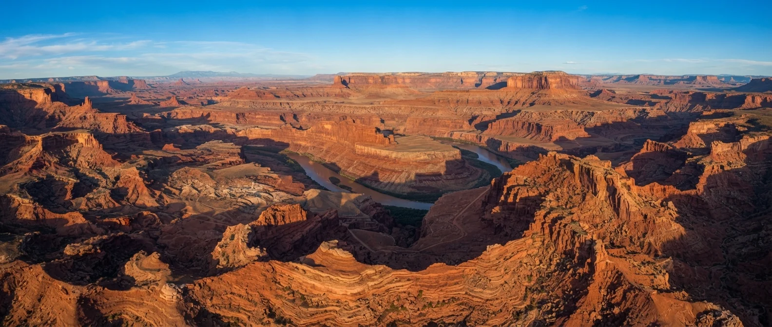
Photo credit: readerspanel.com
In this article
Key facts on geography, entry, accessibility, best seasons, and what distinguishes each major Western national park from the others.
Why the Western parks are unlike anything else
The national parks of the American West span desert floors below sea level, glaciated peaks above 14,000 feet, ancient sequoia groves, and one of the longest exposed geological records on the planet. They are not interchangeable. Each park has a distinct character shaped by geology, elevation, and climate, and choosing the right one for your trip depends on knowing what sets them apart.
This reference covers the major Western parks across California, Nevada, Utah, Arizona, Wyoming, Colorado, and Washington. It is organized around the facts most useful at the planning stage: entry requirements, best travel windows, physical demands, and the one or two features that define each park's identity.
| Number of national parks in the American West (11 western states) | Approximately 63 (National Park Service) |
| America the Beautiful Pass price | $80 per year (NPS, subject to change) |
| Lowest point in North America | Badwater Basin, Death Valley, -282 ft (USGS) |
| Highest recorded temperature at Death Valley | 134 degrees F (July 1913) (NPS/NOAA) |
| Yellowstone geysers | More than 500 (National Park Service) |
| Arches documented natural arches | More than 2,000 (National Park Service) |
| Grand Canyon length | 277 river miles (National Park Service) |
| Hoh Rain Forest annual precipitation | 140-170 inches (Olympic National Park/NPS) |
Park-by-park reference
Grand Canyon (Arizona)
The canyon is 277 river miles long, up to 18 miles wide, and drops roughly a mile from rim to river. The South Rim is open year-round; the North Rim closes mid-October through mid-May due to snow. Summer temperatures on the inner canyon trails routinely exceed 110 degrees F, making dawn starts and adequate water non-negotiable. Most visitors see only the rim; a corridor trail hike to the Colorado River and back is a multi-day commitment requiring a backcountry permit obtained by lottery months in advance.
Zion (Utah)
Zion Canyon's walls reach 2,000 feet above the Virgin River floor. The park operates a mandatory shuttle system through the main canyon from spring through fall; private vehicles are restricted on Zion Canyon Scenic Drive during peak season. Angels Landing and The Narrows are the two most recognized routes. Angels Landing requires a permit (also lottery-based); The Narrows involves wading the Virgin River and can be closed during flash flood risk periods. Check river conditions with the park before entering.
Bryce Canyon (Utah)
Bryce sits at 8,000 to 9,100 feet elevation, making it considerably cooler than Zion or the Grand Canyon. Its signature feature is the hoodoo: a tall spire of rock formed by freeze-thaw erosion of soft sedimentary layers. The park has no river canyon; instead, its amphitheaters face east and catch the sunrise in a way that turns the orange and red limestone formations vivid. Snow in winter makes the hoodoos more dramatic and the crowds smaller.
Arches (Utah)
The park has more than 2,000 documented natural arches, the highest concentration anywhere on Earth. Delicate Arch is the most photographed; it requires a 3-mile round-trip hike with 480 feet of elevation gain across open slickrock. Timed entry reservations are required between April and October; they sell out weeks in advance. Summer midday heat in Moab can exceed 100 degrees F.
Yosemite (California)
Yosemite Valley holds El Capitan, Half Dome, and Yosemite Falls within a roughly 7-mile glacially carved corridor. The valley is the most visited section, but the park also includes the high-elevation Tuolumne Meadows (open only in summer) and old-growth sequoia groves in the Mariposa Grove. A timed entry reservation system applies during peak season for entry into the valley. Half Dome permits are required for the cable route and are lottery-based.
Yellowstone (Wyoming/Montana/Idaho)
Yellowstone sits atop one of the world's largest active volcanic systems. It holds roughly half of Earth's known geothermal features, including more than 500 geysers. Old Faithful erupts roughly every 44 to 125 minutes (the interval varies with each eruption). The park covers 2.2 million acres and wildlife viewing is a primary draw: bison, wolves, grizzly bears, and elk are commonly seen. Roads at higher elevations close from November through April or May.
Olympic (Washington)
Olympic is rare in that a single park boundary contains temperate rainforest, glaciated peaks, and Pacific coastline. The Hoh Rain Forest receives 140 to 170 inches of precipitation per year. The coast is accessible on foot along Rialto Beach and is known for sea stacks and tide pools. No road crosses the park; reaching different ecosystems requires separate entry points.
Death Valley (California/Nevada)
Death Valley holds the record for the highest reliably recorded air temperature on Earth: 134 degrees F at Furnace Creek in July 1913. Badwater Basin at minus 282 feet is the lowest point in North America. The park is more accessible in fall through early spring; summer hiking is genuinely dangerous and the park itself recommends against it outside of early morning hours near trailheads.
Entry, permits, and passes
Every park listed here charges an entry fee; most are $35 per vehicle as of the time of writing, though fees change periodically. The America the Beautiful Interagency Annual Pass covers entrance fees at all federal lands for $80 per year and is worth considering if you plan to visit more than two or three parks. It is available at any park entrance station or through Recreation.gov.
Several parks now require timed entry reservations separate from the entrance fee. Arches, Yosemite Valley, and Zion Canyon have all used these systems in recent years. Check the specific park's National Park Service page (nps.gov) before booking travel, since reservation windows open months ahead and sell out.
Backcountry permits for popular routes (Half Dome cables, Angels Landing, Grand Canyon Corridor) use lottery systems that open weeks to months before the season. If a specific iconic hike is central to your trip, build your itinerary around the permit window, not the other way around.
Always verify current requirements before you go
Reservation systems, permit lotteries, road closures, and fee amounts change from season to season and year to year. The authoritative source for each park is its individual page on nps.gov. Check it within a few weeks of your trip, since conditions listed in any third-party guide (including this one) may be out of date.
Accessibility and seasonal considerations
Accessibility varies sharply. Most parks have paved viewpoints, accessible restrooms, and shuttle systems that accommodate wheelchairs and mobility aids. Rim Trail at Grand Canyon's South Rim is largely paved and accessible. Yosemite Valley has accessible shuttles and flat valley floor paths. Backcountry trails are generally unpaved and steep; individual trail accessibility details are on each park's nps.gov page.
Altitude affects visitors at Bryce Canyon, Rocky Mountain, and Yellowstone's higher sections. Symptoms of altitude sickness (headache, nausea, fatigue) can appear above 8,000 feet, especially on the first day. Consult a healthcare provider before traveling to high elevations if you have cardiovascular or respiratory concerns; this article is general travel information, not medical advice.
Spring and fall generally offer the best balance of comfortable temperatures and smaller crowds at most Western parks. Summer is peak season with the longest days but also the most visitors, reservation pressure, and heat at lower-elevation parks. Winter closes some roads but opens uncrowded access to parks like Bryce and Crater Lake, where snow transforms the landscape.
Hoodoo
A tall, thin spire of rock formed when a harder cap rock protects softer sediment beneath from erosion. Common in Bryce Canyon and other Colorado Plateau parks.
Timed entry reservation
A system requiring visitors to book a specific entry window before arriving at a park, separate from paying the entrance fee. Used to manage crowding at high-demand sites.
Backcountry permit
An authorization required to camp or travel in undeveloped areas of a national park beyond designated trailheads and campgrounds. Many popular routes use lottery systems.
Slickrock
Smooth, exposed sandstone or other bare rock surfaces common in Utah's desert parks. The name is misleading; dry slickrock has good grip, but wet surfaces become extremely slippery.
Geothermal feature
Any surface expression of underground heat, including geysers, hot springs, fumaroles, and mud pots. Yellowstone's concentration of these features is exceptional worldwide.

Author
Travel & Adventure Editorial Team
Travel & Adventure Editorial Team is the collective byline for our editorial team and contributor network. Articles published under this byline or an editorial pen name are researched, written, and reviewed according to our editorial standards for clarity, consistency, and independence before publication.
View all articles →