
The Scottish Highlands: Landscape, History, and What Makes It Unlike Anywhere Else in Europe
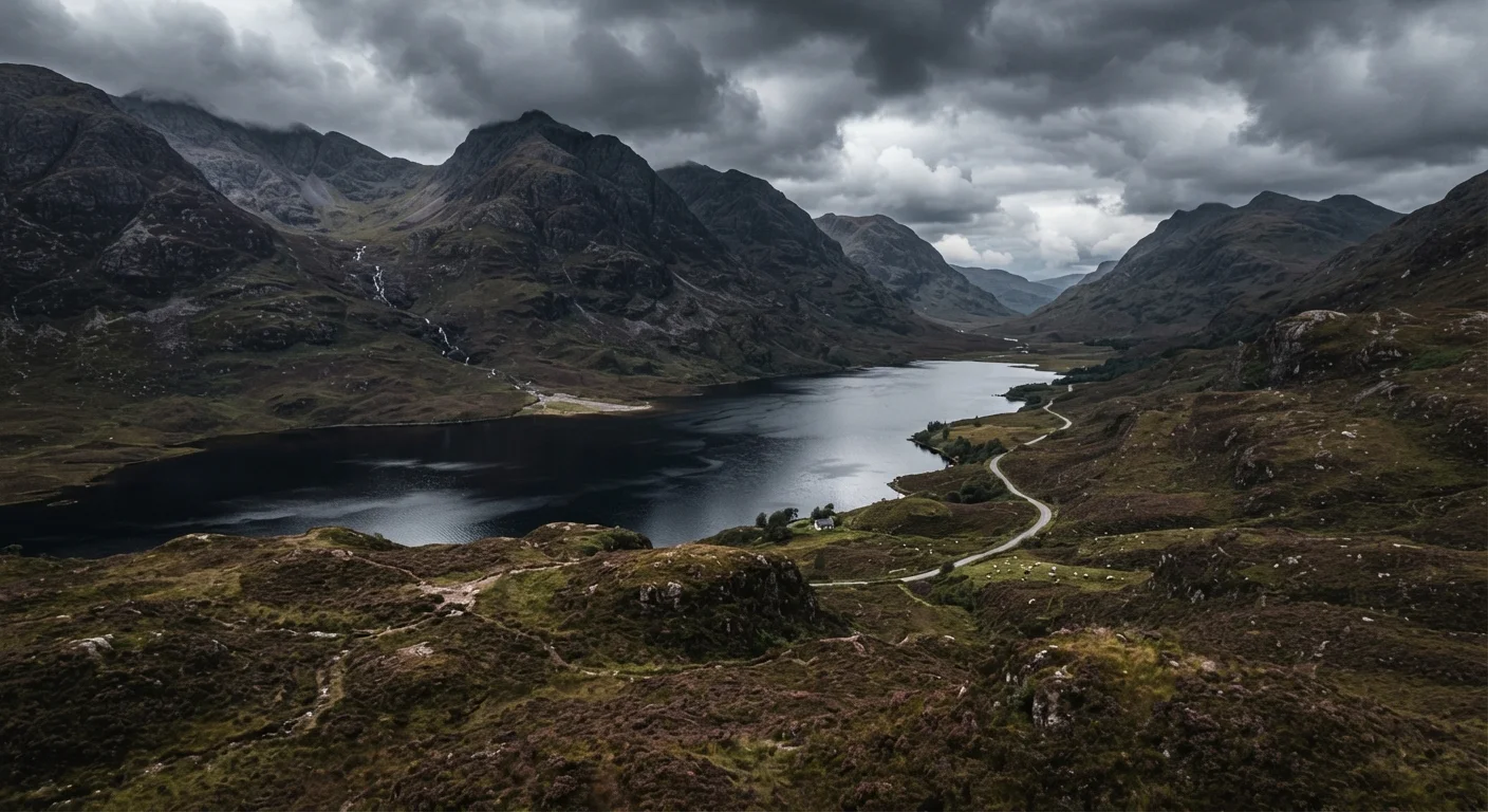
Photo credit: readerspanel.com
In this article
A grounding overview of the Scottish Highlands, covering its dramatic geography, layered history, and the experiences that draw visitors from around the world.
Key Takeaways
- The Scottish Highlands contain some of the oldest exposed rock on Earth, dating back around 3 billion years.
- The Highland Clearances of the 18th and 19th centuries depopulated vast areas, which still shapes the sparse settlement patterns visitors see today.
- Weather in the Highlands is genuinely unpredictable year-round; layered, waterproof clothing is necessary regardless of season.
- Scotland has some of Europe's most open access rights for walkers, but responsible use and navigation skills matter.
- The region spans roughly 10,000 square miles, so travel times between points are much longer than a map suggests.
What the Highlands actually are
The Scottish Highlands are not a single administrative region or a park with a defined boundary. The term describes a geographic and cultural zone that covers roughly the northern two-thirds of Scotland, where the terrain rises sharply from the Central Belt and the landscape becomes dominated by mountains, moorland, and water. The boundary is loosely drawn along the Highland Boundary Fault, a geological line running from Helensburgh in the west to Stonehaven on the east coast.
Within that broad territory, there is enormous variation. The far northwest has a different character from the Cairngorms plateau in the east; the glens that run toward Inverness feel nothing like the open flow country of Caithness near the north coast. Visitors who treat the Highlands as one uniform experience tend to come away with an incomplete picture.
The geology and landscape in plain terms
The Highlands sit on Lewisian gneiss in their northwestern reaches, rock formed around 3 billion years ago and among the oldest exposed geology anywhere on the planet. The mountains themselves are worn-down remnants of ranges that were once comparable in scale to the Alps. Repeated glaciation carved the landscape into its current form: the long, narrow sea inlets called sea lochs, the U-shaped valleys, and the countless freshwater lochs that hold more water by volume than all lakes in England and Wales combined.
Loch Ness, despite its fame, is not the largest loch by surface area. Loch Lomond holds that distinction, though Loch Ness contains more water because of its depth. Ben Nevis, at 1,345 meters (4,413 feet), is the highest point in the British Isles. The summit is above the cloud line on most days of the year, which means the view from the top is genuinely rare.
The moorland that covers much of the interior is not simply wild or untouched. Centuries of grazing and deliberate burning for grouse management have kept tree cover minimal across areas that would otherwise support woodland. Conservation efforts are actively working to restore native forest in several areas, with the Caledonian Forest remnants at places like Glen Affric among the most visible examples.
Travelers who are curious about similarly ancient and isolated geology in another part of the world might find the comparison with Iceland's interior highlands useful, where volcanic processes rather than glaciation have shaped an equally raw terrain.
On the term 'wilderness'
The Highlands are often described as Europe's last wilderness, but that framing is not accurate. The land has been farmed, burned, grazed, and cleared for centuries. What visitors experience is a heavily modified landscape that looks open because the human population is sparse, not because the land is untouched. This context matters for understanding the ecology and the history.
A layered history worth knowing before you go
The Highlands were inhabited long before written records. Pictish carved stones, many still standing in fields and churchyards, date from roughly the 4th to 9th centuries and represent a distinct culture that predates the Gaelic kingdom of Scotland. The Norse had a long presence along the western and northern coasts, and place names across Sutherland, Caithness, and the islands carry that inheritance clearly.
The Jacobite risings of the 17th and 18th centuries, and their defeat at Culloden in 1746, led directly to the suppression of Gaelic culture and clan structures through the Act of Proscription. The aftermath matters to understanding the region today. The Highland Clearances, which ran roughly from the 1750s through the late 19th century, saw landlords forcibly remove tenant farming communities from the land to make way for sheep. Entire glens that once held hundreds of people became empty. The low population density that makes the Highlands feel so open is not purely natural; it is partly the result of systematic displacement.
Gaelic (Scottish Gaelic, distinct from Irish Gaelic) is still spoken by a small number of people, concentrated mainly in the Western Isles rather than the mainland Highlands. Road signs are bilingual throughout much of the region.
What visitors actually do there
Walking and hiking are the most common activities, and Scotland's Land Reform (Scotland) Act 2003 gives the public access to most land for non-motorized recreation, provided people act responsibly under the Scottish Outdoor Access Code. That means walkers can cross open countryside, camp wild, and follow routes that would be restricted in many other countries. The right comes with obligations around respecting land management, leaving no trace, and keeping distance from livestock.
The Great Glen Way and the West Highland Way are both well-marked long-distance routes with established infrastructure. The Cairngorms National Park, the largest national park in the UK by area, has trails across a high plateau that feels genuinely remote even though it is accessible by road. Munro bagging, the practice of climbing all 282 Scottish peaks above 3,000 feet, has its own dedicated community and culture.
Wildlife is a real draw. Red deer are widespread and visible; golden eagles are present in the northwest and parts of the Cairngorms; ospreys, once extinct in the UK, have recolonized several Highland lochs and can be watched from hides during spring and summer. Bottlenose dolphins are regularly seen in the Moray Firth near Chanonry Point.
Whisky distilleries are concentrated in Speyside but exist across the Highlands, and distillery visits with production tours are available at many locations. The flavor profiles vary significantly by region, making a self-guided distillery circuit a coherent trip theme.
Practical things to understand before planning a trip
Weather is the most important variable to plan around. The western Highlands are among the wettest places in Europe because Atlantic fronts drop most of their moisture as they hit the mountains. Fort William averages over 200 days of rain per year. The east coast and the Cairngorms are drier but colder in winter. No month is reliably dry, and conditions can shift from clear to soaked in under an hour. Midges, the tiny biting insects that appear from late May through September in still, humid conditions, are a genuine nuisance in the west and around lochs. Insect repellent with DEET or a midge head net makes a meaningful difference.
Transport requires planning. The main rail lines reach Inverness, Kyle of Lochalsh, and Fort William, but most of the interior has no rail access. A car gives far more flexibility, though single-track roads with passing places are common and require patience. Driving times are consistently longer than the distances suggest. Cell coverage is absent in many glens.
Accommodation ranges from independent hostels and bothies (basic shelters maintained by the Mountain Bothies Association, free to use) to country hotels. In summer, popular areas book up well in advance. The shoulder seasons of April to May and September to October tend to have fewer crowds, better midge conditions, and reasonable daylight.
This article is for general informational and travel planning purposes only. Entry requirements, travel advisories, road conditions, and access rules can change. Verify current information with official Scottish Government and UK government sources before traveling.

Author
Travel & Adventure Editorial Team
Travel & Adventure Editorial Team is the collective byline for our editorial team and contributor network. Articles published under this byline or an editorial pen name are researched, written, and reviewed according to our editorial standards for clarity, consistency, and independence before publication.
View all articles →