
Iceland's Interior Highlands: What Draws Travelers to One of Earth's Most Isolated Landscapes
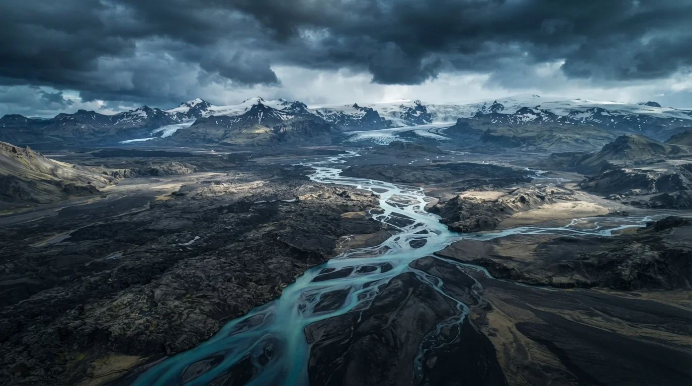
Photo credit: readerspanel.com
In this article
Explore what makes Iceland's uninhabited highlands so compelling, from volcanic deserts to glacial rivers, and what to know before venturing in.
Key Takeaways
- Iceland's highland interior has no permanent residents and is inaccessible by road for most of the year.
- The landscape includes active volcanic areas, glacial outwash plains, and hot spring fields.
- The two main highland routes, Kjölur and Landmannalaugar (F roads), require high-clearance four-wheel-drive vehicles.
- Glacial river crossings on F roads carry real risk; drivers without experience should travel with a guide or join an organized group.
- Weather in the highlands can change rapidly regardless of season; preparation matters more than timing.
A landscape with no residents and almost no roads
The interior of Iceland is roughly the size of Connecticut, and no one lives there. The terrain shifts between black sand deserts formed from volcanic ash, braided rivers fed by glacial melt, and geothermal areas where the ground hisses and bubbles. Lava fields from eruptions centuries old sit alongside formations still warm to the touch. What travelers encounter is a place that the country's own settlement history largely bypassed: even at Iceland's population peak, the highlands were too cold, too exposed, and too volatile for farming or habitation.
F roads, the gravel tracks that cut through the interior, are only passable with a high-clearance four-wheel-drive vehicle. Many of them cross rivers without bridges. The Icelandic Road and Coastal Administration posts updated conditions on their official site; that should be the first stop for anyone planning to drive into the interior. Conditions that look manageable on a map can close a road overnight.
What the terrain actually looks like
The color range across the highlands is wider than most volcanic landscapes suggest. The Landmannalaugar area, reached via the F225 road in the southern interior, has mountains tinted pink, yellow, green, and deep rust from rhyolite, a silica-rich volcanic rock that weathers into those hues. The ground there is warm underfoot in places, and natural hot pools sit within walking distance of the trailhead parking area.
Farther north, the Kjölur route (F35) runs between Iceland's two largest ice caps, Langjökull and Hofsjökull, across a wide gravel plain. The scale is different there: flatter, colder, more austere. The Hveravellir geothermal area sits midway along Kjölur and has been a stopping point for travelers crossing the interior for centuries. It has a small mountain hut and hot pools.
The Sprengisandur route (F26) crosses the darkest part of the interior: a volcanic desert with almost no vegetation, flanked by distant glaciers. It is the most severe of the main highland routes and the least traveled.
Check road status before you leave
The Icelandic Road and Coastal Administration updates F road conditions daily during highland season. A route that was open yesterday may be closed by snowfall, flooding, or soft ground today. Build flexibility into your itinerary so a road closure does not strand your plans.
The draw for travelers
Part of what attracts people to the highlands is exactly what makes them difficult. The absence of towns, light pollution, and persistent crowds is not incidental; it is the experience. On clear nights, the Milky Way is visible without obstruction. Hiking the Laugavegur trail, which covers roughly 55 kilometers between Landmannalaugar and Þórsmörk over four to five days, puts travelers through terrain that covers obsidian fields, glacial valleys, and bright green moss plains in quick succession.
For travelers who have covered Iceland's popular coastal ring road and want a different scale of wildness, the highlands offer that contrast sharply. If you are curious how that kind of landscape-first travel compares to urban-focused trips, our overview of urban versus nature travel works through the practical and personal trade-offs.
The highlands also sit apart from European highland landscapes in instructive ways. Scotland's highlands have centuries of layered settlement history written into their terrain; Iceland's interior has none of that. The land there has not been shaped by farming, clan territory, or long-term habitation. What you see is primarily the result of geology, not human activity.
~40,000 km²
Area of Iceland's uninhabited interior
The highlands make up roughly 40 percent of Iceland's total land area and have no permanent residents.
55 km
Length of the Laugavegur hiking trail
The Laugavegur trail runs from Landmannalaugar to Þórsmörk and is generally completed in four to five days.
~6-10 weeks
Typical highland road season per year
Most F roads are accessible for only about six to ten weeks annually, depending on snowmelt and weather conditions each year.
What to prepare before going
Anyone entering the highlands should register their planned route with safetravel.is, Iceland's official travel registration service, before departure. This is not a formality: search and rescue in Iceland is conducted by volunteer teams, and a filed route plan can determine how quickly they can respond if something goes wrong.
Gear priorities include layered waterproof clothing, because temperature and precipitation can shift within an hour, and a satellite communicator or personal locator beacon, because mobile coverage across most of the interior is either minimal or absent. Food and fuel should account for more time than the route seems to require.
Travelers who are not experienced with glacial river crossings should consider joining a guided vehicle convoy or hiring a highland-experienced guide for F road routes that include them. Crossing a glacial river incorrectly is one of the more common causes of serious incidents in the interior. The depth and current of those rivers change through the day as glacial melt accelerates in afternoon warmth.
This article is for general informational purposes only. Travel conditions, road accessibility, and safety requirements in Iceland's highlands change seasonally and without advance notice. Always verify current road status with the Icelandic Road and Coastal Administration and safety guidance with safetravel.is before departing.
Frequently Asked Questions

Author
Travel & Adventure Editorial Team
Travel & Adventure Editorial Team is the collective byline for our editorial team and contributor network. Articles published under this byline or an editorial pen name are researched, written, and reviewed according to our editorial standards for clarity, consistency, and independence before publication.
View all articles →